Page 1 of 20
CUT BENCH MARK
Posted: Sun 26 Jul, 2015 12:30 am
by Brunel
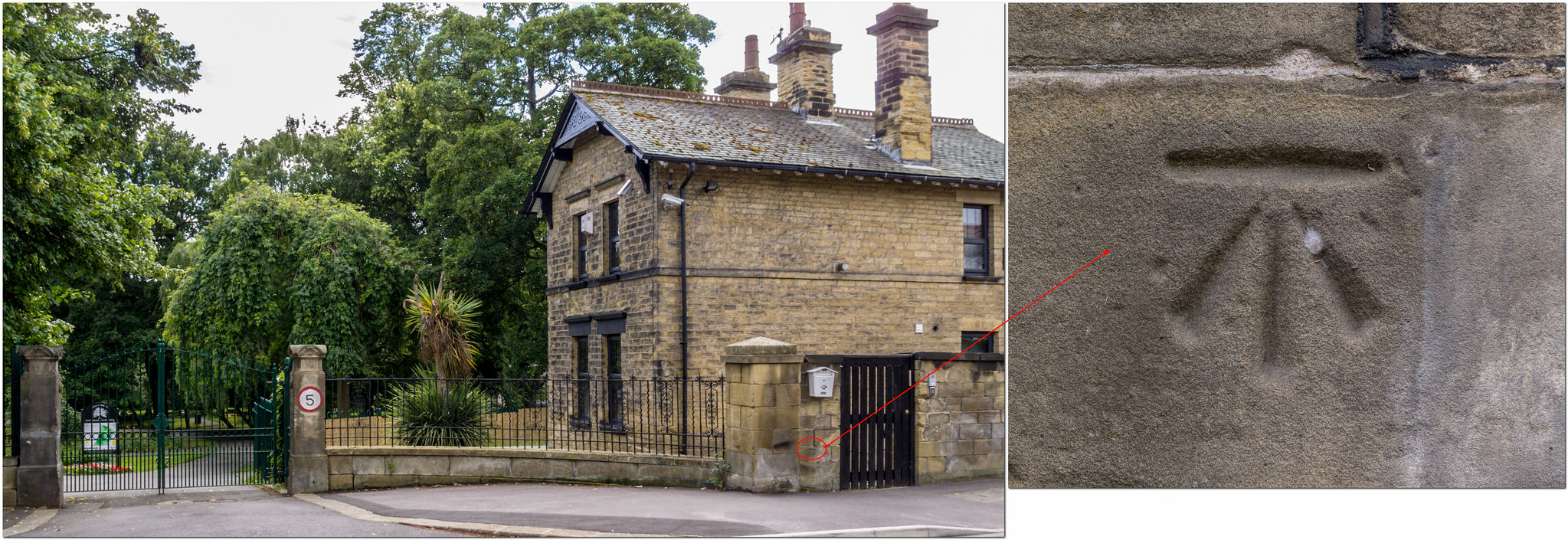
Especially for Christian Lüts
The building is the former P.O. at Oakwood.
All you need to find these old bench marks is an old 6" Ordnance Survey map, preferably dated from the 1900's
You can even use an online copy.
http://maps.nls.uk/geo/explore/#zoom=17 ... layers=171
 CUT BENCH MARK
Re: CUT BENCH MARK
Posted: Sun 26 Jul, 2015 12:43 am
by Leodian
That's a nice Bench Mark (BM) so thanks for that Brunel

.
I like to 'find' BMs and have used old OS maps to do so, but sadly many BMs have gone. It's great to come across a BM that is not noted on maps. I have long intended to try to find the many BMs noted in the centre and close by area of Leeds but I've never yet got round to finding more than a few.
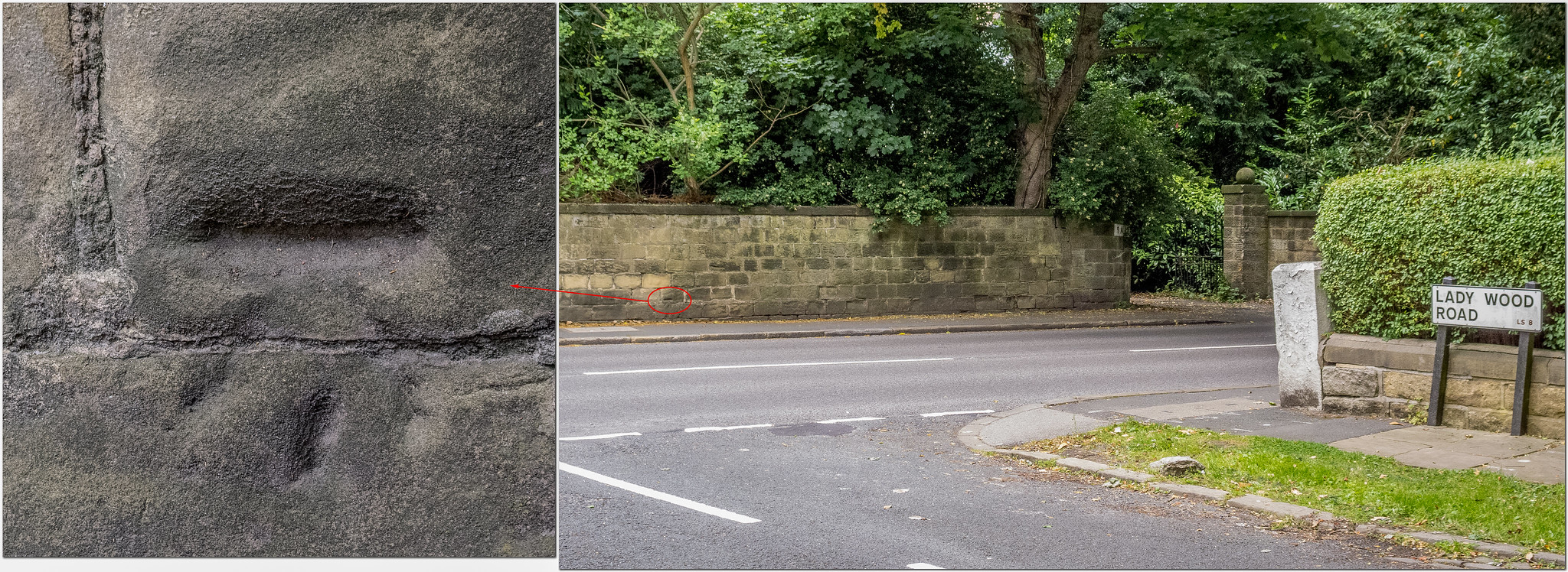
Re: CUT BENCH MARK
Posted: Sun 26 Jul, 2015 8:02 am
by Brunel
Three BM's marked on this section of the 6" map
The two circled in green still extant.
Re: CUT BENCH MARK
Posted: Thu 30 Jul, 2015 11:24 am
by Brunel
Re: CUT BENCH MARK
Posted: Thu 30 Jul, 2015 3:12 pm
by blackprince
If like me you want to know what these marks were used for and the reason they are called "bench marks" this article give a good explanation
http://www.heritageandhistory.com/conte ... 0937500000
Re: CUT BENCH MARK
Posted: Thu 06 Aug, 2015 11:04 pm
by Brunel
Re: CUT BENCH MARK
Posted: Fri 07 Aug, 2015 9:06 pm
by chameleon
Many church spires and towers were frequently ustilised as triangulation points ( largely superseded by GPS of course), those used for this are noted on OS maps and all have a bench mark at ground level.
Re: CUT BENCH MARK
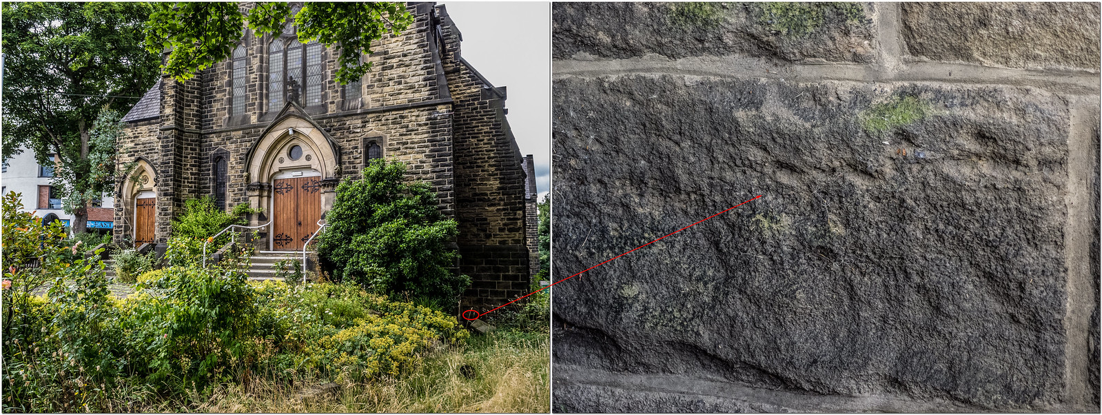
Posted: Sun 09 Aug, 2015 10:58 pm
by Brunel
MEANWOOD METHODIST CHURCH B.M
GRADE II LISTED. Now redundant, probably will be recycled into flats...shops..Wetherspoons?
Edit:
https://publicaccess.leeds.gov.uk/onlin ... M1IJB17S00
http://www.openstreetmap.org/?mlat=53.8 ... 82/-1.5670
Re: CUT BENCH MARK
Posted: Fri 14 Aug, 2015 11:35 pm
by Brunel
Re: CUT BENCH MARK
Posted: Sat 15 Aug, 2015 8:48 am
by liits
chameleon wrote:Many church spires and towers were frequently ustilised as triangulation points ( largely superseded by GPS of course), those used for this are noted on OS maps and all have a bench mark at ground level.
A good example of a church tower used as a triangulation point and indicated with a BM [whcih was not used as a leveling line BM] and which also has a BM is St John's Church, Briggate.
The tower has a flush bracket plate for the leveling - this is the only flush bracket I've found in Leeds while the trig is indicated by a cut benchmark in the boundary wall on Briggate. The BM is beside and below the blue plaque and I've tried to photograph it twice but its proximity to the bus stop means that it always seems to have somebody leaning against it!